After my first month in the Pamir I finally started to see the Tajik National Park myself. I’ve had read a lot about this territory, its wildlife, official management plans, reports and feasibility studies. But I didn’t have any idea about what it might look like in reality. How is the touristic infrastructure? How are the roads? Is the territory accessible at all? Are there local guides who could take us to glaciers, show us where to see Marco Polo Sheep, tell us more about ancient mining cities, holy shrines, solar calendars and petroglyphs?

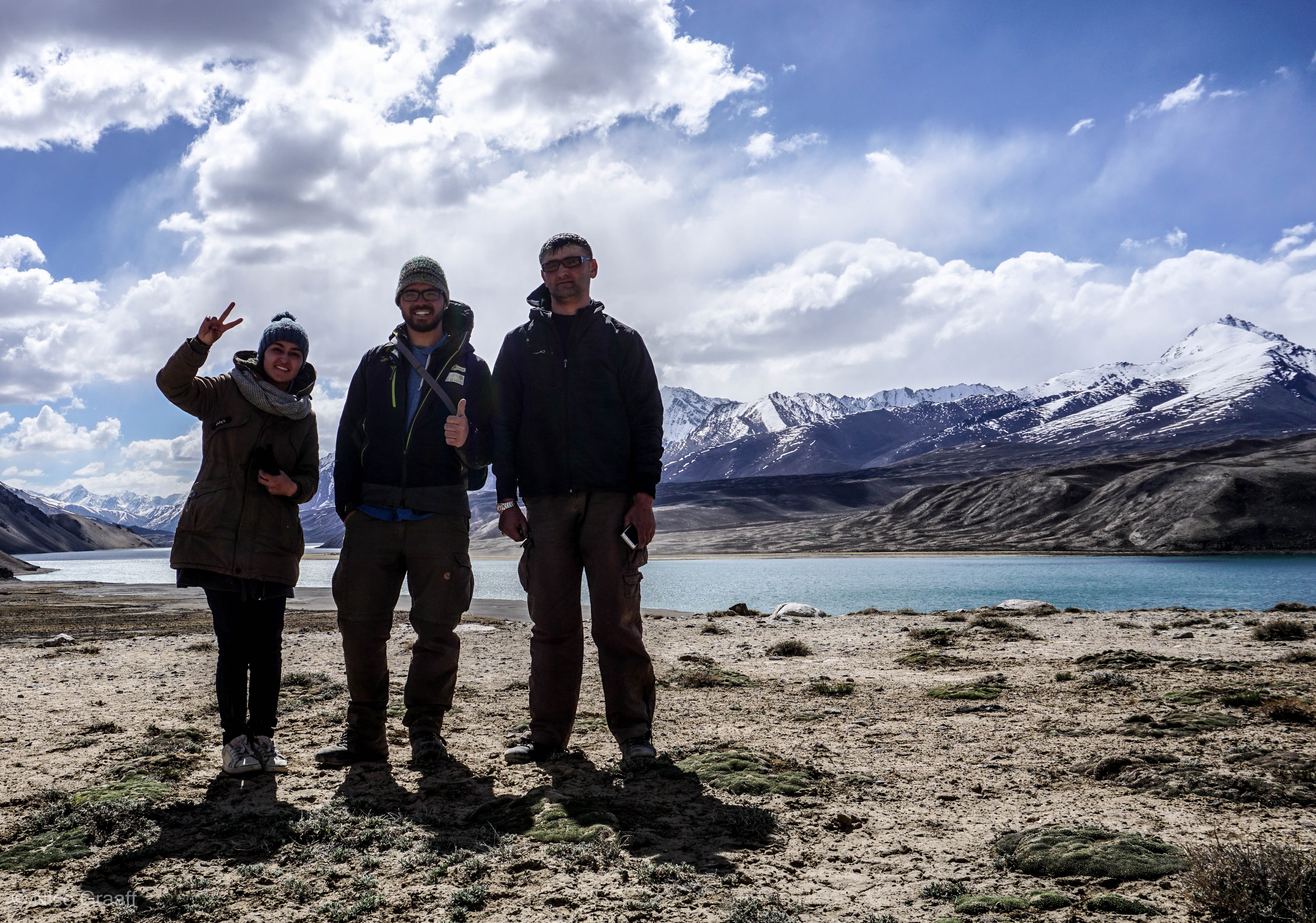
So on a Saturday morning we sat off in an old Russian jeep, packed with tents, sleeping backs, hiking equipment, a lot of food, camera, gps, etc….I was accompanied by two rangers from the Tajik National Park and a PECTA Volunteer, helping me as a translator and in documenting the existing and potential infrastructure in and around the National Park. Our aim for the first day was the western and of Yashilkul Lake.

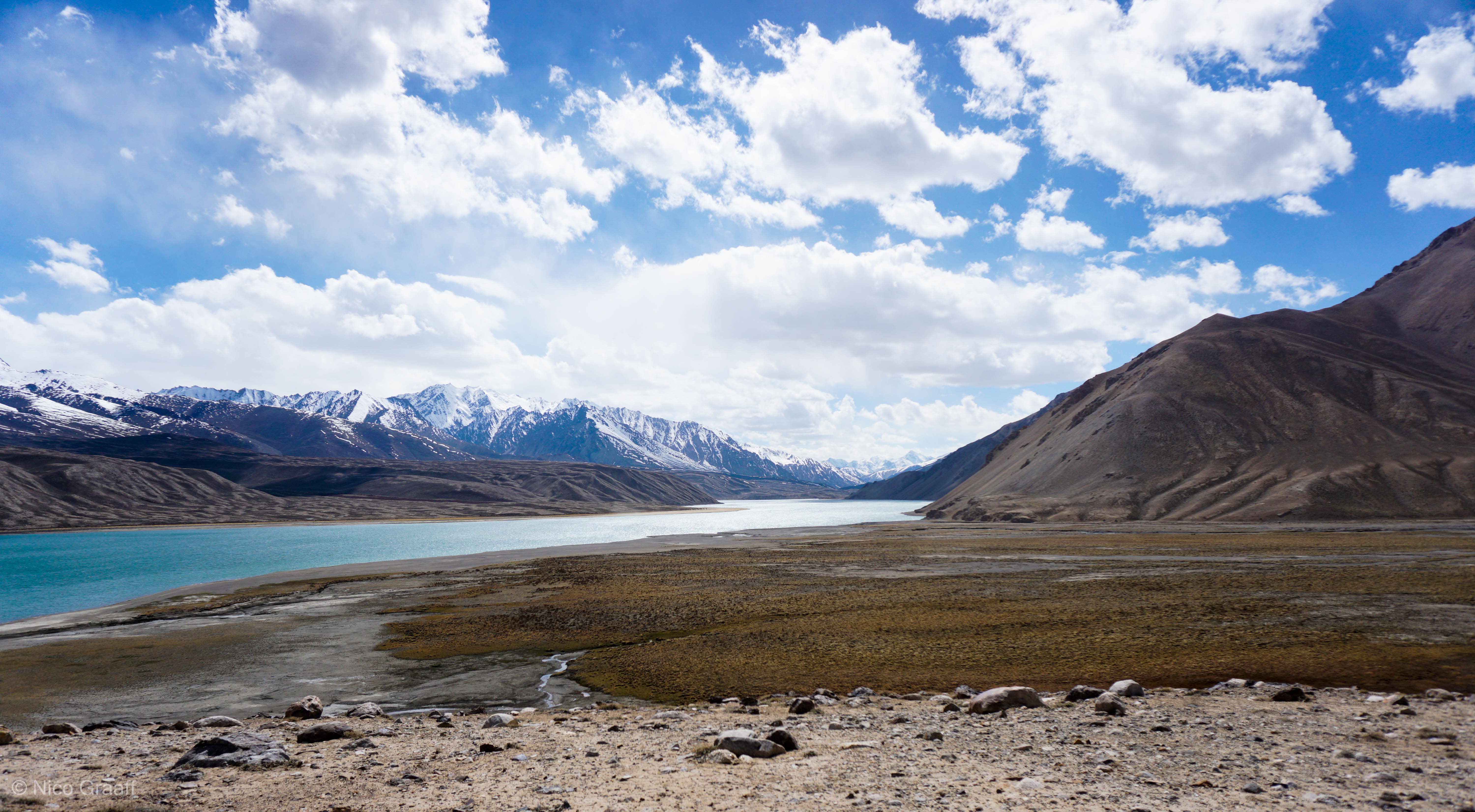
Yashilkul can be seen as the little brother of the northern Sarez Lake. The origin of both was a huge landslide caused by an earth quake which blocked the Alichur (Yashilkul) respective the Murghab River. Sarez Lake is supposed to be the youngest alpin lake in the world and of great geological interest. It took 9! years to be filled up (1911-1920). Unfortunately the access to Sarez Lake is not officially open for tourists. But the massive boulders at the western end of Yashilkul give you a quite impressive example of the unimaginable forces set free when ground moves and mountains crush.

At the western end of Yashilkul there is a big hangar and a small hut. Home to an employee of Pamir Energy. In the beginning 2000s Pamir Energy, the Pamiri energy company, build a regulation canal at Yashilkul to regulate the water flow out from the lake into the Ghund river. The Ghund river streams from Yashilkul to the west, along the Pamir Highway, until it reaches Khorog. Khorog, capital of the Pamir, is home of probably the biggest water electricity plant in the Pamir Mountains.
After our first night in a small room inside the hangar, we started our first hike. Maps of the Pamir (scale 1:500 000) show a hiking trail on the northern end of Yashilkul. But we had differing information if the trail is still accessible. Furthermore it was not sure if the car could go around the eastern end of the lake to pick us up at the solar calendar, half way from east to west on the northern shore. So we started walking, without knowing exactly how far we had to go…12, 15 or even 20 kilometers.
To be honest 20 kilometers seemed quite a lot for me at this time, as I’ve never been too much the hiking type. But this should change during the trip…
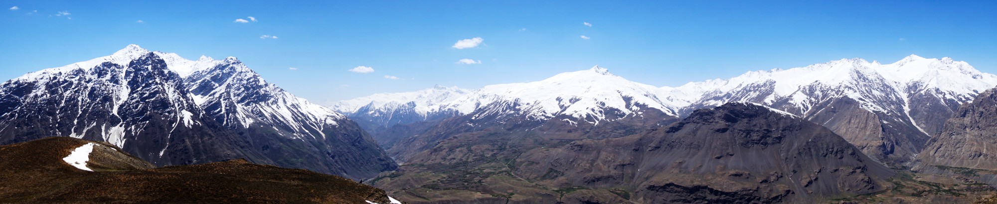
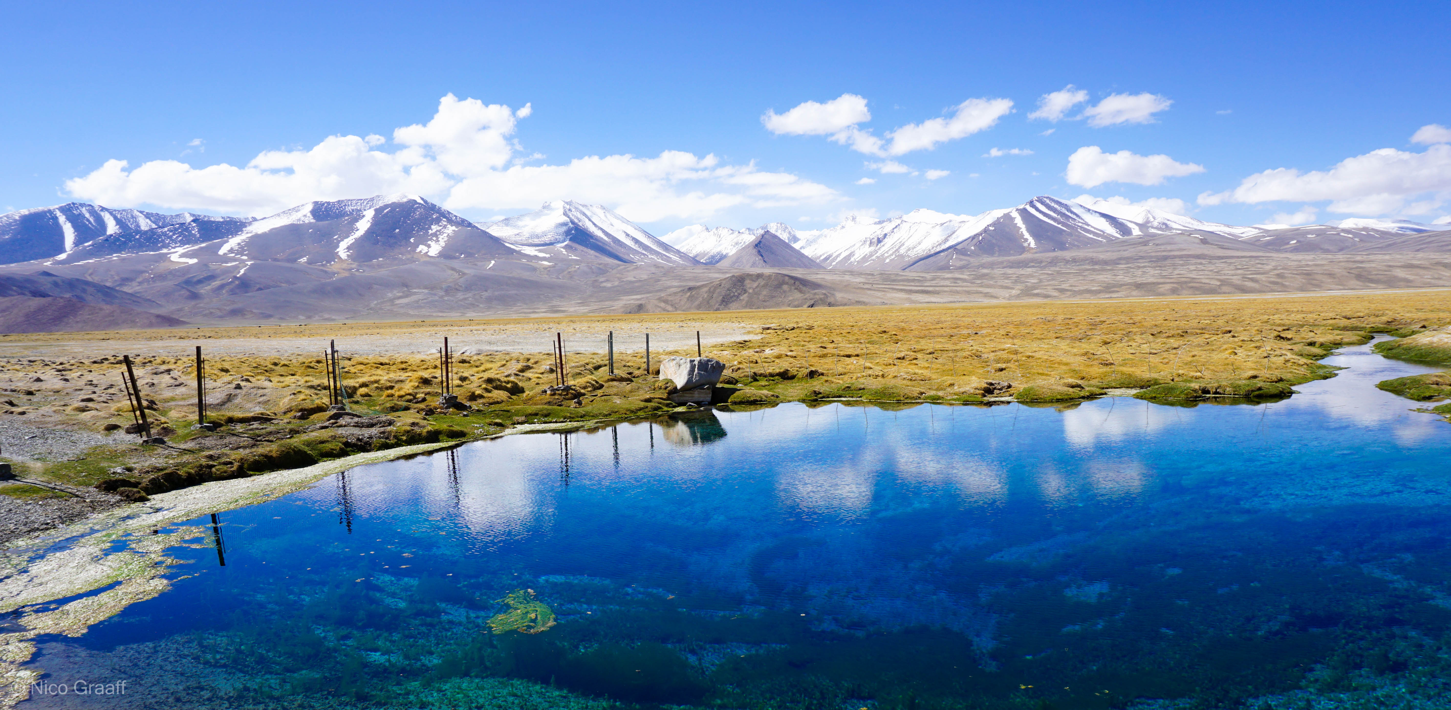
As you can see on the pictures, Yashilkul is amazing. The track always stays near to the water. A small path leads you the way. There are 2 rivers to cross. Easy to do so in the beginning of June. You might have to take off your pants when you go in Sep.-Oct. when water level has risen. But nothing that would force you to return I suppose. You’ll find a lot of beautiful camping possibilities at the shore. Only shadow is hard to find. The path underground differs from gravel, to ball big rocks, to sand to grass. Most of the time nice to walk on.
The car could pick us up at the solar calendar as planed after about a 14 kilometers hike. The track can be seen and downloaded on OpenStreetMap, which is also used by maps.me. A freeware App suitable for hiking and biking. A trip description will be available with the PECTA tourism information center in Khorog by the end of June.
The calendar at Yashilkul is not the most impressive of its kind. You’ll just see a circle of stones when you don’t have any further information. PECTA is working on improving this situation.
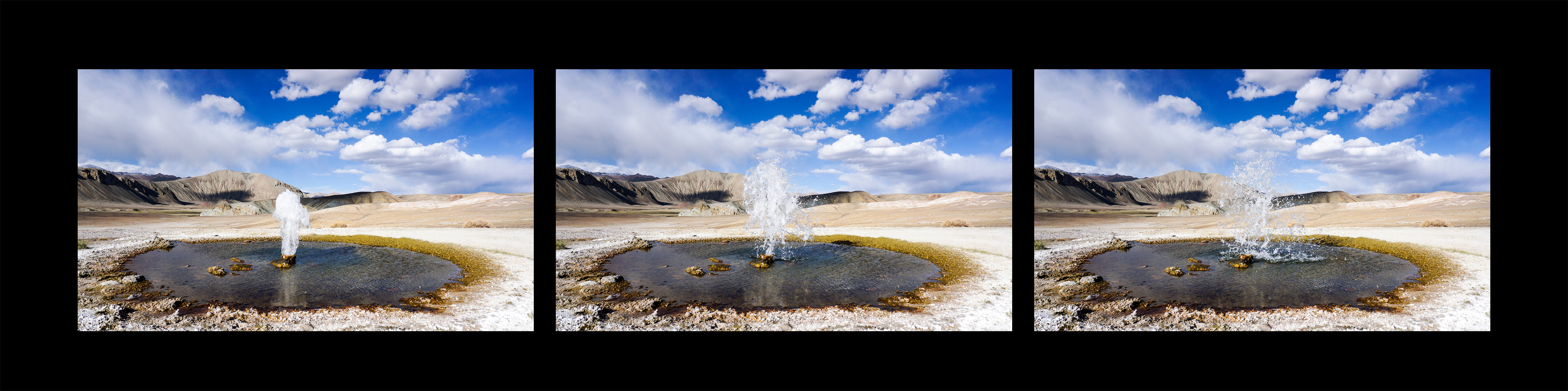
If you really like hiking, you as well can continue east on the northern shore. There is a dirt road you can follow or try to find a path near to the lake. At some point you have to cross the Alichur River. Then continue following the river upstream and you’ll pass by a nice Hot Spring (hidden in this small hut), a mineral spring and a Geyser.


In Alichur we were joined by Makhan. He is not only the National Park Ranger of the Alichur Region but as well the head of the Alichur Wildlife Conservancy. The Alichur area was confronted in the past with a lot of illegal hunting activities. With the help of Pantheras Snow Leopard Program (see http://www.panthera.org/species/snow-leopard/tajikistan for more information) they achieved to convince the community to protect the area from this and build a simple touristic infrastructure. So instead of hearing firing rifles you’ll have a very good chance to see some endangered species around Alichur (e.g. Marco Polo sheep and Ibex). Though it is very hard to take good pictures without a tele lens. Here was my try shot through the observation telescope…


About 15 Kilometers east down the Pamir Highway you can enter the Valley of Bazardara. On a very bad road, in the beginnig of June stil covered with snow, you will reach a the East Barzardara Pass at 4664 meters ASL. Then the way turns west and leads you to and old silver mining city, dated to the 11th century

In soviet times there has been some resarch projects on this. PECTA is right know in process to arrange a information brochure about this.
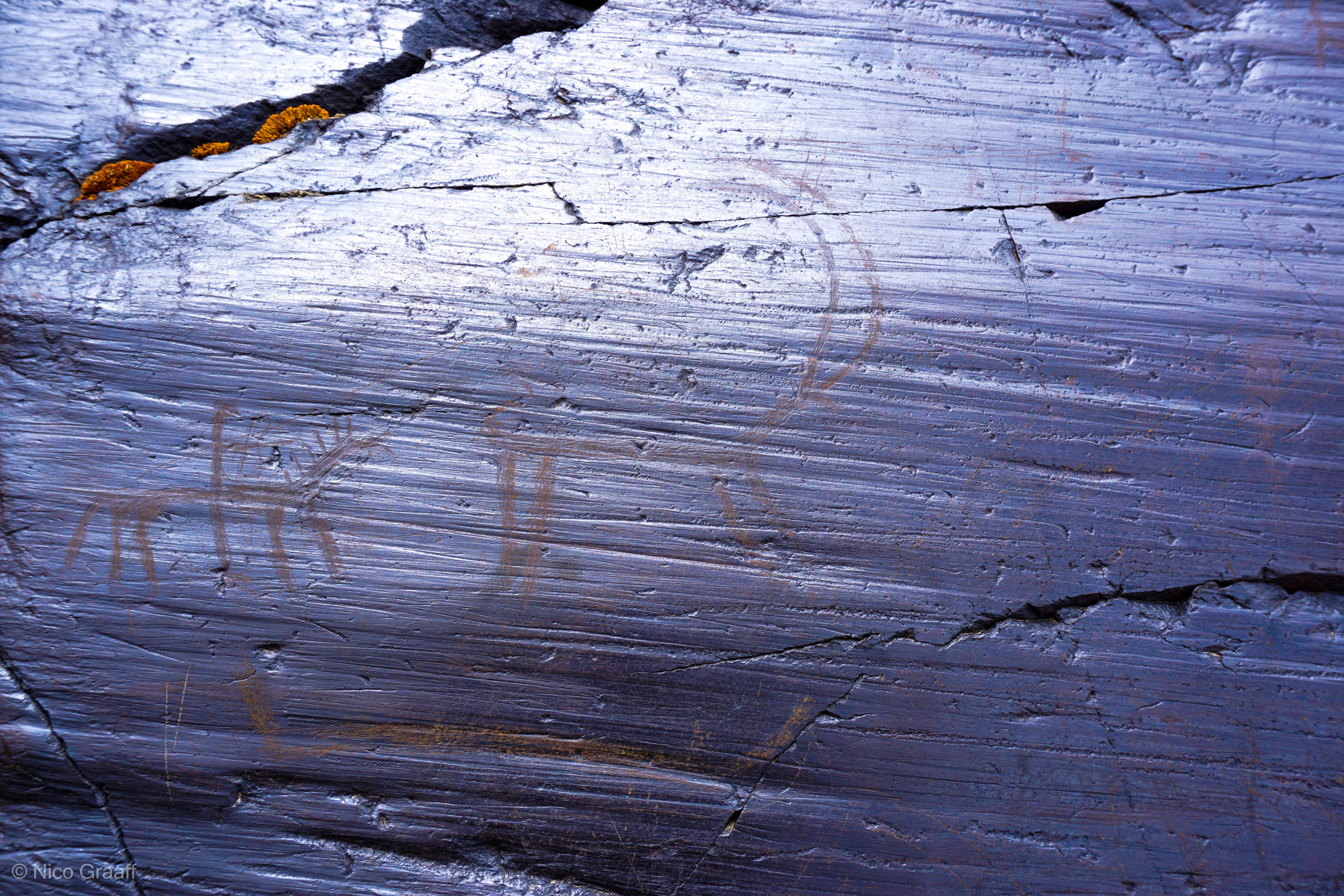
Further down the road you find some Petroglyphs. Unfortunately some people do not respect this and destroy this pictures by adding their name tag…
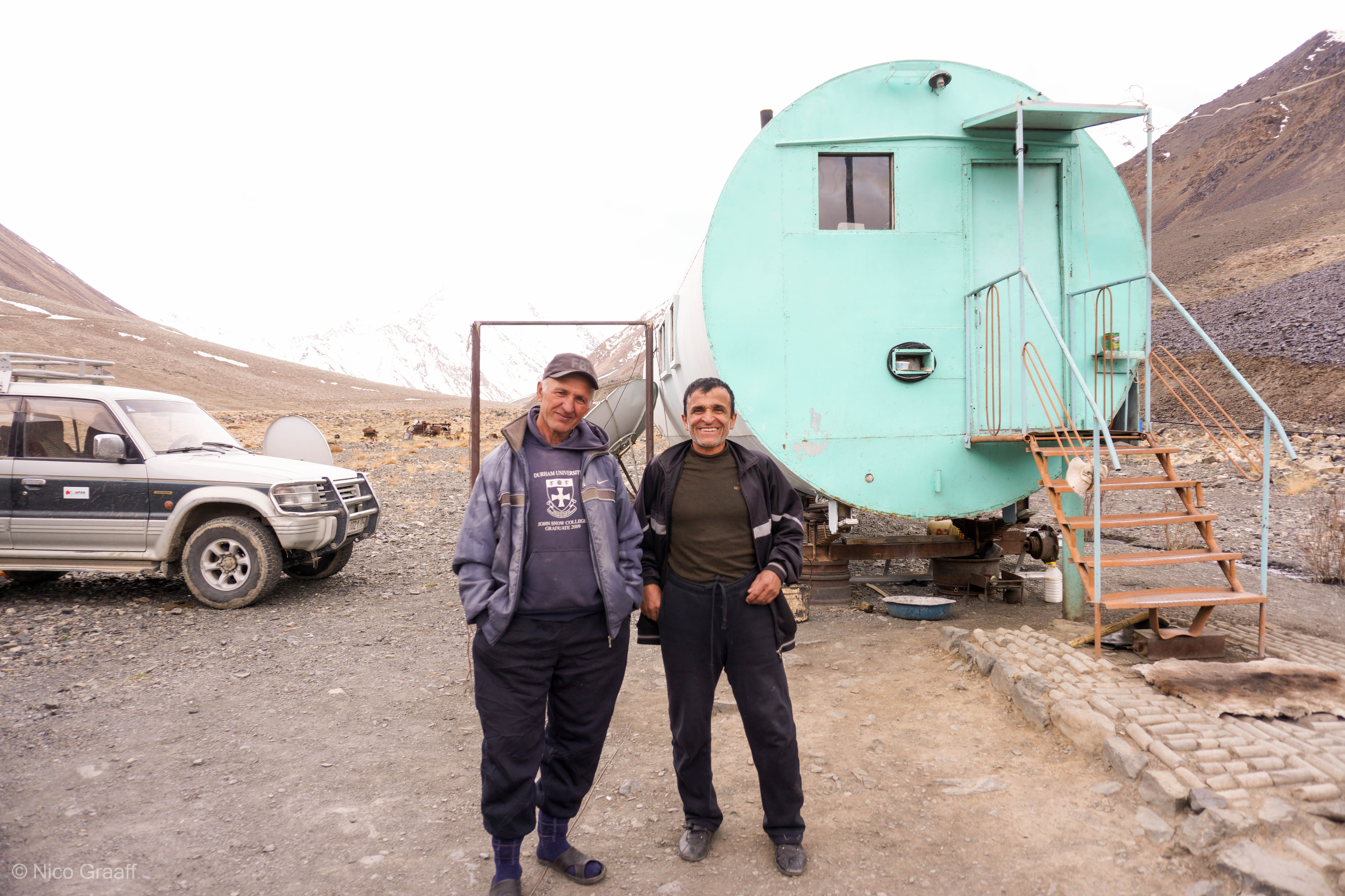
Just 5 more Kilometers from here, you reach the new mining camp. Some Pamiris prepare and maintain the equipment for the near by silver mine. Mining shall start Summer 2015, oraganized by chinese.
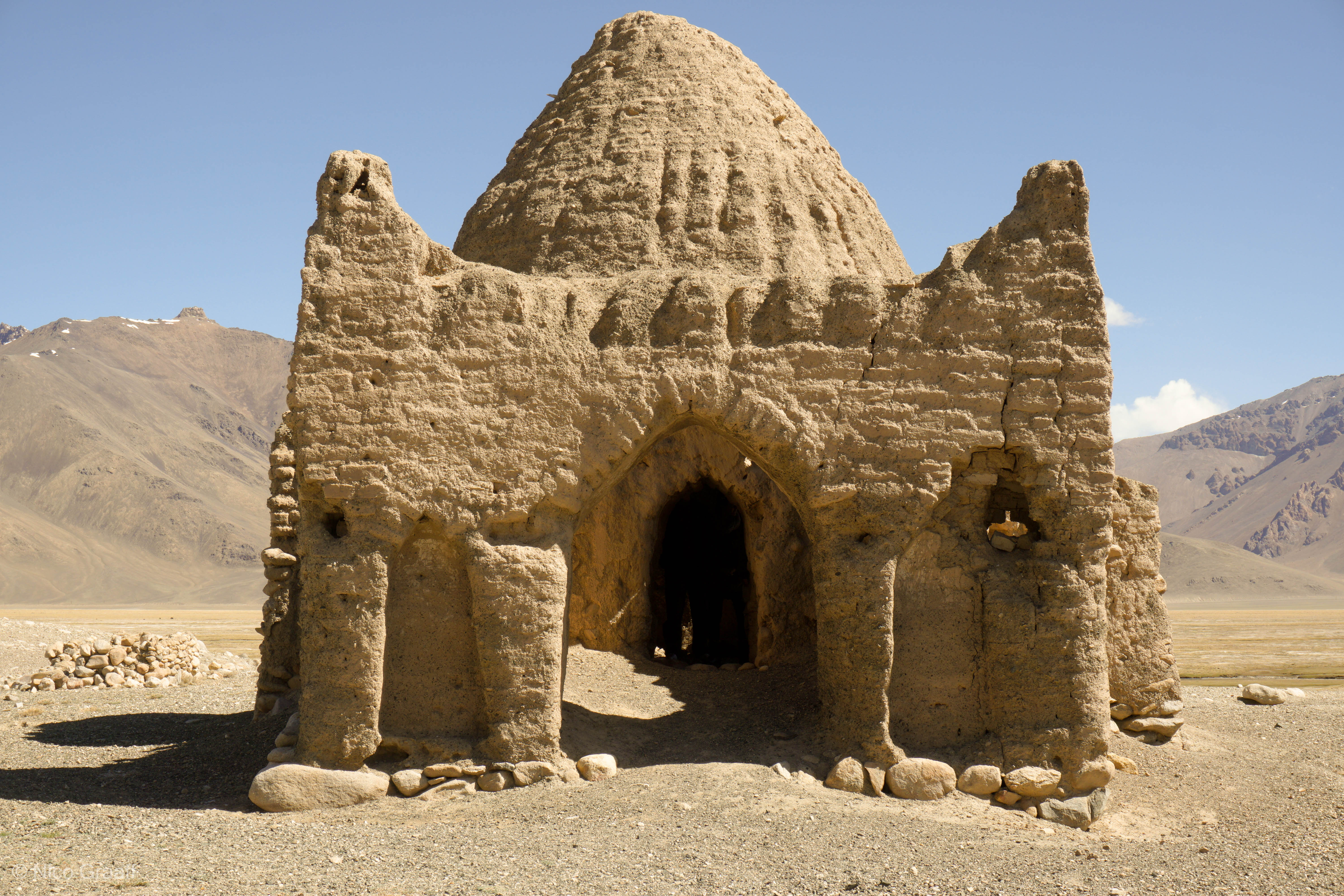
When you head further east to Murgah, stop by Bash Gumbez to see one of the best preserved Caravanserais in the Pamirs. They where used by caravans in the medieval for shelter.
I think this is enough for this post….
Hope you enjoyed the photos! Part 2 of the National Park Report will be about Hiking inside the park to a crashed airplane and the Grum Grjimailo Glacier.
Good bye …..!